
Blog / Missing Middle Housing
Is My House in the Toronto Yellowbelt? How to Check in Four Steps
Written by Anthony Palleschi · November 7, 2026 · 7 min read
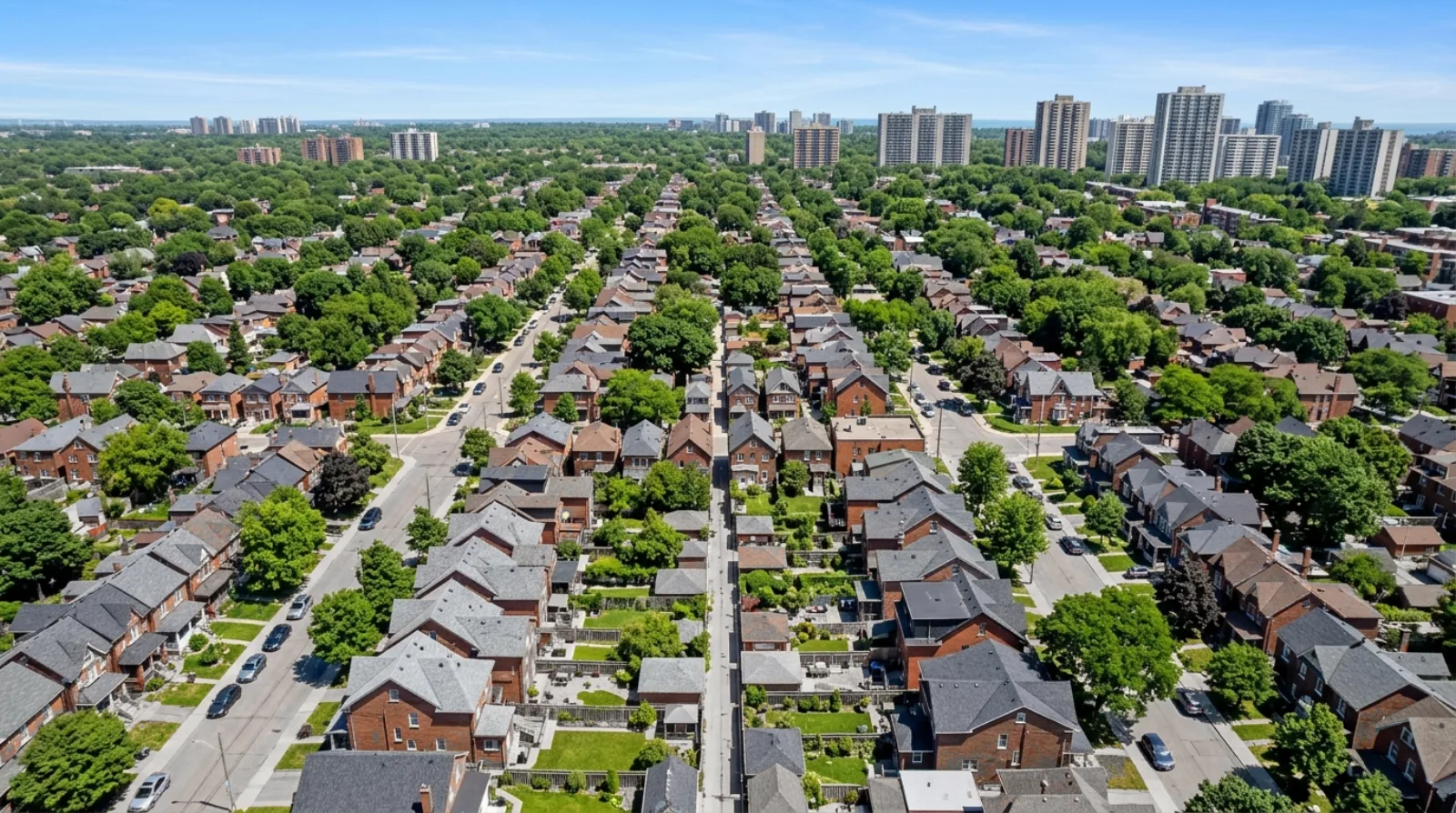
Is your house in the Toronto yellowbelt? Since the City started allowing multiplexes, garden suites and small apartment buildings on house lots, the answer matters for what your lot could hold. You can find it in four steps on the City's own maps. I'm Anthony Palleschi, a real estate sales representative in Toronto, and I work with owners and builders on these lots. This post shows how to check, using City of Toronto pages as they read on November 1, 2026.
For the background (how much land the yellowbelt covers and how the rules have changed), see my earlier post, Toronto's Yellowbelt: Opportunities and Challenges.
What "yellowbelt" means
The yellowbelt is the land that Toronto's Official Plan designates as Neighbourhoods. The Official Plan is the City's long-term plan for how land is used. Its land use maps colour each designation, and Neighbourhoods are yellow.
Chapter 4 of the Official Plan describes Neighbourhoods as "physically stable areas" of lower-scale homes: detached houses, semi-detached houses, duplexes, triplexes and townhouses, and walk-up apartments of four storeys or less. Official Plan Amendment 727 added an exception: along Major Streets, apartments may be up to six storeys.
"Yellowbelt" is an informal name. On the maps and in the by-laws, look for the word Neighbourhoods.
Step 1: open the land use map for your area
Go to the City's Official Plan Maps page. It has a section called "Maps 13-23 Land Use," with one PDF map for each part of the city. The page says the maps "are current as of the June 2026 consolidation."
If you do not know which map covers your street, the same page has a "Search by Map" tool. You select one of the areas labelled A to K, and it shows the land use map, Secondary Plans and other policy maps for that part of the city.
Step 2: read the colour on your lot
Each land use map has a legend on the right. On Map 15, for example, the legend lists these designations:
| Colour on the map | Designation | What it usually holds |
|---|---|---|
| Yellow | Neighbourhoods | Houses, duplexes to fourplexes, townhouses and walk-up apartments |
| Orange | Apartment Neighbourhoods | Larger apartment buildings |
| Red | Mixed Use Areas | A mix of shops, offices, homes and institutions |
| Greens | Natural Areas, Parks, Other Open Space Areas | Parks, natural areas, golf courses and cemeteries |
| Blue and purples | Institutional Areas and Employment Areas | Institutional and employment uses |
Zoom in on your street. If your lot sits inside the yellow shading, it is designated Neighbourhoods. The maps are drawn at a city scale, so a lot at the edge of two colours can be hard to read. In that case, check the zoning in step 3 and ask City Planning.
Here is what that looks like on Map 15, which covers the south of Etobicoke, with Highway 427, Kipling Avenue, Islington Avenue, Royal York Road and Park Lawn Road marked on it. Most of the land between the main roads is yellow. Red strips of Mixed Use Areas run along several of the main roads. Large purple Employment Areas sit in the middle of the map near the Gardiner Expressway, and green parks follow the lake and the river valleys. A house on a side street in the yellow is in the yellowbelt. A house in one of the red strips is in a Mixed Use Area, even if it is a house today.
The Map 15 legend also says the map "includes known in-effect Official Plan Amendments (OPAs) up to OPA878." A newer amendment for your area may not be on it yet.
Step 3: look up your zone label
The Official Plan sets the broad type of area. The zoning by-law sets the detailed rules for each lot. You need both.
Open the City's Zoning By-law Interactive Map, search your address, and read the zone label on your lot. Most yellowbelt lots carry a residential zone: R, RD (detached), RS (semi-detached), RT (townhouse) or RM (multiple dwelling). The label can also carry a "u" number for the most units allowed, and a reference to a Chapter 900 exception written for your street. The City's Zoning By-law 569-2013 page links to the map and to the by-law text.
My guide to Toronto multiplex zoning explains how to read the label and count what your lot can hold.
Step 4: check two more things
Two facts change the answer for a yellowbelt lot:
- Is the lot on a Major Street? Major Streets are drawn on Map 3 of the Official Plan. A yellowbelt lot that abuts one can hold townhouses or an apartment building of up to six storeys. My post on Major Streets zoning covers those rules.
- Is the lot in a sixplex area? The City's Multiplex Housing page says four-unit multiplexes are permitted city-wide and six-unit permissions vary by location. Under By-law 654-2025, the sixplex areas are the Toronto and East York district and Ward 23.
What the answer means
This section is my own view of what each answer tells an owner.
If your lot is yellow and in a residential zone, the City's multiplex, garden suite and laneway suite rules are the ones to read first. A builder looking at your lot will count homes under those rules, which I explain in my post on how builders price land.
If your lot is yellow and abuts a Major Street, it may be worth more to a builder together with your neighbours' lots, because two or three lots can hold a larger building.
If your lot is orange or red, it is outside the yellowbelt. Apartment Neighbourhoods and Mixed Use Areas have their own policies, and the multiplex rules may not be the right starting point. Ask before you assume either way.
If your lot is yellow but sits inside a Secondary Plan or a site-specific policy, the extra policy can change what the City expects for your street. Read it, or ask City Planning.
There is no obligation to do anything with the answer. Knowing your designation and your zone lets you judge offers and advice with your own facts.
Questions to ask about your lot
- What colour is my lot on the Official Plan land use map?
- Does a Secondary Plan or a site-specific policy cover my street?
- What zone label and "u" number does my lot carry?
- Does my lot abut a road on Map 3?
- Is my lot inside the Toronto and East York district or Ward 23?
If you have checked your lot and want to talk about what it could become, see how I work with sellers, or reach me through the contact page or at 416-636-6800.
Planning and development potential is property-specific and subject to zoning, approvals, site conditions, municipal review and other due diligence.
Sources
All pages opened on November 1, 2026 (PT).
- City of Toronto, Official Plan Maps page (date modified June 19, 2026): Maps 13 to 23 for land use, the "Search by Map" areas A to K, and the June 2026 consolidation.
- City of Toronto, Official Plan Map 15, Land Use Plan (published June 2026): the legend, the colours, and amendments included up to OPA 878.
- City of Toronto, Official Plan Chapter 4 (date modified June 17, 2026): the description of Neighbourhoods, Apartment Neighbourhoods and Mixed Use Areas.
- City of Toronto, Zoning By-law 569-2013 page and its Zoning By-law Interactive Map: zone labels by address.
- City of Toronto, Multiplex Housing page: four units city-wide and six units by location.
- City of Toronto, By-law 654-2025: the sixplex areas.
- City of Toronto, By-law 1061-2025 (Official Plan Amendment 727): six-storey apartments along Major Streets.
Frequently asked questions
What is the Toronto yellowbelt?
The Toronto yellowbelt is the land that the City's Official Plan designates as Neighbourhoods. The City's land use maps colour this designation yellow, which gives the name. Chapter 4 of the Official Plan describes Neighbourhoods as physically stable areas of lower-scale homes, such as detached and semi-detached houses, duplexes, triplexes, townhouses and walk-up apartments.
How do I check if my house is in the Toronto yellowbelt?
Open the City of Toronto's Official Plan Maps page, choose the land use map (Maps 13 to 23) that covers your area, and find your street. If your lot is shaded yellow, it is designated Neighbourhoods and sits in the yellowbelt. The City says the maps are current as of the June 2026 consolidation of the Official Plan.
What colours do the other areas have on Toronto's land use maps?
On the City of Toronto's Official Plan land use maps, Neighbourhoods are yellow, Apartment Neighbourhoods are orange, and Mixed Use Areas are red. The legend also lists Natural Areas, Parks, Other Open Space Areas, Institutional Areas, Regeneration Areas, General and Core Employment Areas, and Utility Corridors, each in its own colour.
Is the Official Plan designation the same as my zoning?
The Official Plan designation and the zoning are two separate City documents. The designation, such as Neighbourhoods, sets the broad type of area. The zone label in Zoning By-law 569-2013, which you find on the City's Zoning By-law Interactive Map, sets the detailed rules for your lot, such as the number of units, height and setbacks.
Can I build a multiplex if my house is in the yellowbelt?
Most yellowbelt lots in Toronto's residential zones can hold a multiplex of up to four homes in one building, according to the City's Multiplex Housing page. Up to six are allowed in the Toronto and East York district and Ward 23. The final number depends on your lot's zone label, its size and any zoning exception.
What if my house is in a yellow area that faces a Major Street?
A Toronto lot designated Neighbourhoods that abuts a road on Map 3 of the Official Plan can hold townhouses or an apartment building of up to six storeys, under Official Plan Amendment 727 and Zoning By-law 1062-2025. Check Map 3 for your road, and check that your lot abuts it directly.
What is an Apartment Neighbourhood in Toronto's Official Plan?
Apartment Neighbourhoods are areas in Toronto's Official Plan where larger apartment buildings are allowed. Chapter 4 of the Official Plan says they are distinguished from low-rise Neighbourhoods because a greater scale of buildings is permitted. On the City's land use maps they are coloured orange, while the yellowbelt Neighbourhoods are coloured yellow.
How current are Toronto's Official Plan land use maps?
The City of Toronto's Official Plan Maps page says the maps are current as of the June 2026 consolidation of the Official Plan. Map 15, for example, says it includes known in-effect Official Plan Amendments up to OPA 878. An amendment adopted after that may not appear yet, so ask City Planning about recent changes for your street.